Routes: Miabhaig to Bowglass
There is limited parking at the start, please ensure you do not block the road or use a passing place as a car park!
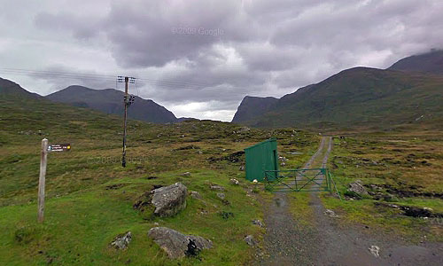
The route heads north from the green stalkers hut, following a gently rising and undulating landrover track to the Loch Voshmid fishing hut at just over 4 miles from the start. So far it is an easy ride on a good gravel surface (easy that is unless you are heading into a northerly wind!) The biggest danger here is of crashing because you are looking up at the spectacular scenery rather than watching where you are going!
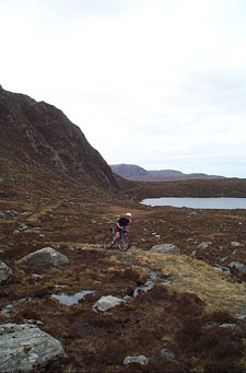
At the hut, you turn right onto a narrower and more naturally surfaced trail. This has some interesting single track which flows over some hummocky glacial moraines (this whole area was covered by glaciers only 18,000 year's ago!). Care is sometimes required as you cross the river (there is no bridge so you are probably going to get your feet wet!)
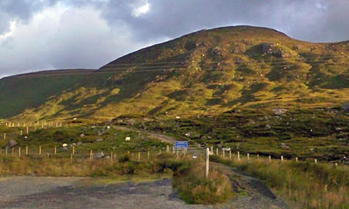
This signals the start of the hard stuff - around 300m of climbing! In good conditions it is possible to clean this section but usually the surface is slippy and it is very difficult to retain traction on the steeper sections - so some shoving will probably be required. As you head to the 6 mile marker there is a short descent into a spectular corrie below Creag Chleistir (look out for deer and eagles on the surrounding hills). Not too much respite here though as the route carries on up to the high point of the route at around 330m.
The descent down to the river is quite technical because of erosion to the trail. There are soft sections ready to stop you in your tracks and steep twisting turns - take care!. The descent finishes at the river which is usually easy to ford (the original bridge is washed away). If the river is too high, head about 200m upstream where a new bridge has been built but to which there is no obvious trail!
Another steep 140m climb follows which is almost certainly going to require a bit of hike a bike! Although the new improved surface makes it a lot easier than it used to be!
From the bealach it is straight forward downhill blast to the finish - the only hazard being a quick splash through a small stream which should cause no problems.
The trail ends at a good sized car park. So far you have covered 10.5 miles and the tough ones among you might want to reverse the route - which is just as good (if not better)! If you opt for the 12.7 mile road ride back to the start, dont think that just because it is on tarmac that it is going to be easy! There are several major climbs on the way.
Enjoy!
Interactive Route Map
Got Google Earth? Click here to open route in Google Earth or here to Fly the route
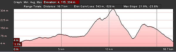
Elevation Profile - Miabhaig to Bowglass